
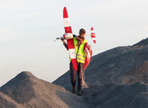
UAV / UAS mapping service
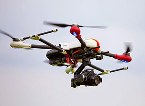
Within last years, Gravionic's UAV (Unmanned Aerial Vehicle) or UAS (Unmanned Aerial System) mapping service became an important tool for small, medium and large scale survey work like surveys of landfills, opencast minings, dikes, etc.. Further important applications are aerial photography, aerial inspections (e.g. wind power plants, oil and gas pipelines), and real time surveillance.
A long term cooperation with the Institute of Flight Guidance of the Technical University of Braunschweig enables us to deliver class leading and cost effective solutions due to several years experience in using Unmanned Aerial Systems.
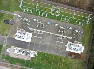
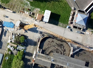
We offer a complete photogrammetric solution based on aerial imagery. Based on RGB pictures captured from high-resolution cameras on board our multi-rotor or fixed wing UAV's, we create:
- Geo-Referenced Digital Elevation Models
- Geo-Referenced Digital Terrain Models
- Geo-Referenced Orthomosaics
- Point Clouds and 3D Models / Maps
- Precision Calculations and Measurements (Volume / Area / Elevation)
Furthermore we also offer Vegetation Health Monitoring using NIR (Near Infrared) cameras as an optional payload for our UAV's. The infrared light band is useful in determining vegetation health in green plant matter. By manipulating this NIR image we can determine the NDVI value (Normalized Difference Vegetation Index) for each pixel in the image. This can help in determining weak spots in crop areas and in seeing change in plant health over time. Agronomists are using this technology more and more to monitor crops due to the availability of cost effective UAV solutions.
In result the utilization of Unmanned Aerial Vehicles for use in survey applications provides our clients with increased production efficiency through the minimization of on-site down time and a new standard in risk management, with limited human machine interaction, ultimately providing increased levels of safety. Beside their surveying knowledge our highly trained UAV pilots are skilled to interact professionally with the other aircraft in the airspace around the survey site.
Our UAV systems are often launched from an off-site location close to the target area, fly a pre-programmed flight path to acquire large volumes of data through high-resolution geo-referenced images.
We provide efficient and accurate survey deliverables based on the latest in survey and unmanned technologies.
Gravionic GmbH
Hermann-Blenk-Str. 27+29
38108 Braunschweig
Germany
Phone: +49 531 26 25 18 4
Mobile: +49 172 8777183
E-Mail: service@gravionic.de